

CONVENTO DI COSPITI
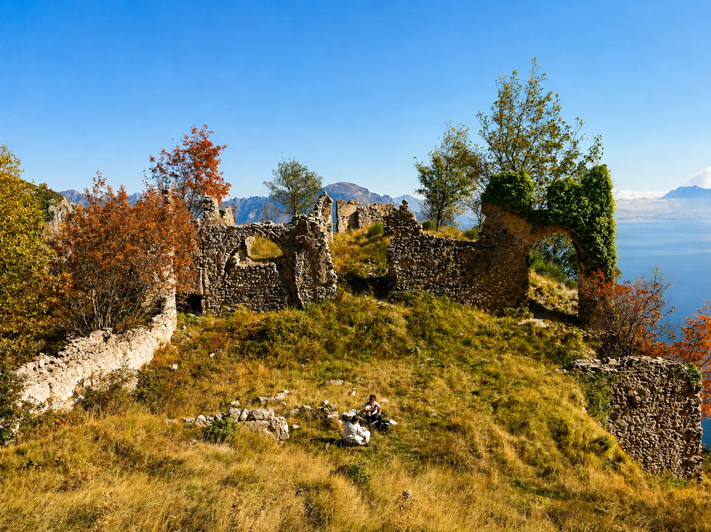
A moderately difficult trail that crosses Monte Murillo and offers a fantastic view overlooking Amalfi and the surrounding area, as well as the romantic ruins of a solitary medieval convent, abandoned during the 19th century and which became a hideout for bandits following the unification of Italy.
FROM SAN LAZZARO TO THE RUINS OF THE COSPITI CONVENT
Information about the route
From Piazza Avitabile, continue towards Punta Belvedere. After approximately 100 metres, turn left onto Via Radicosa and follow the uphill road to its end.
Pass a noticeable left-hand bend and continue straight along the ascending lane that leads into the village of Santa Lucia. After the last houses, continue up a flight of stone steps.
The trail then levels out, crossing a beautiful coppice chestnut forest. After about 200 metres, near a centuries-old chestnut tree, turn right onto a mule track. After approximately 300 metres of gentle ascent, the path bends left and runs alongside a rocky cliff (exercise caution).
At a narrow and steep ravine, you will reach a challenging rock descent leading to a grassy ledge overlooking the ruins of the monastery, which are already visible from above. This section is not recommended for inexperienced hikers or anyone suffering from vertigo, although a handrail is provided to assist with balance.
From here, the descent becomes relatively easy, following the base of the impressive vertical rock face until reaching the plateau where the monastery ruins stand.
After visiting the site, begin the return journey by following the fenced trail that climbs inland towards the north-east, passing below a rocky wall. Once the cliff ends, take the path on the left, which winds through chestnut woods along the southern slope of Mount Murillo before descending back to Santa Lucia.
Alternative route: Visitors wishing to avoid the exposed rock descent may simply follow the return route described above in reverse, using it for both the outward and return journey. This option is easier and suitable for a wider range of hikers.
Information on landmarks and points of interest
Despite its relatively short length, this hike to the eastern edge of Agerola’s territory offers a remarkable variety of landscapes, panoramic views and historical interest.
Leaving the last houses behind, the trail follows an ancient mule track that, during the Middle Ages, connected Agerola to Amalfi via Cospita and Vettica Minore. As you complete the ascent towards Mount Murillo, spectacular views open up to the west: the Agerola Valley seems to float above the Amalfi Coast, while the island of Capri emerges behind the imposing silhouette of Monte Tre Calli.
Beyond the ridge, the landscape changes dramatically. The descent reveals a rugged limestone environment shaped by the powerful forces that formed the Apennine Mountains. Towering cliffs, small natural caves and striking rock formations characterize this section of the trail, including a slender pinnacle traditionally believed by locals to resemble a monk. It is thought that the monks of the Monastery of San Salvatore de Cospiti, the destination of this route, carved the stone steps that still help visitors negotiate the final descent.
The exact date of the monastery’s foundation remains unknown, although it is mentioned in documents dating back to the 12th century. According to local tradition, it was visited by Saint Francis of Assisi and Pope Sixtus IV. The monastery was built on a narrow natural terrace suspended between the sheer cliffs descending from Mount Murillo to the Nocito Gorge, creating an extraordinary setting of peace and spirituality.
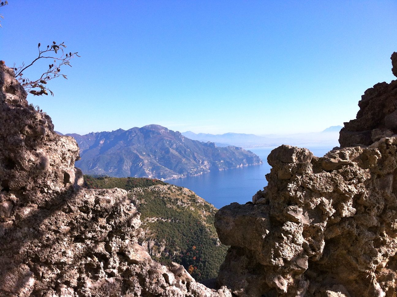
The small cave located above the monastery ruins, partially shaped by human hands, was likely used as a place for prayer and solitary contemplation. Today, whether motivated by faith or simply by a love of nature, every visitor is captivated by the breathtaking panorama stretching across Amalfi, which appears almost within reach below, Ravello, the Monti del Demanio, Capo d’Orso, and the deep blue waters of the Gulf of Salerno.